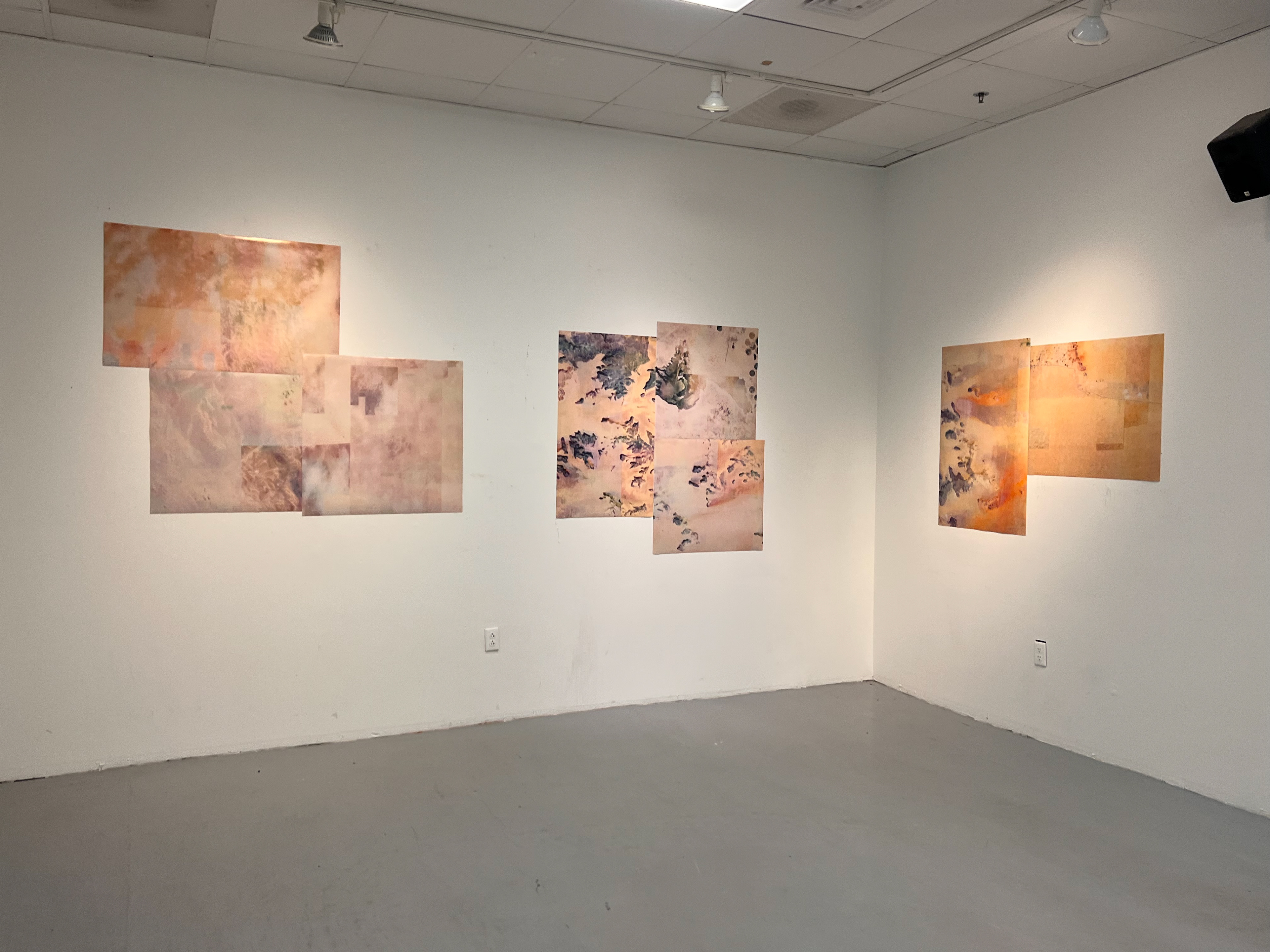
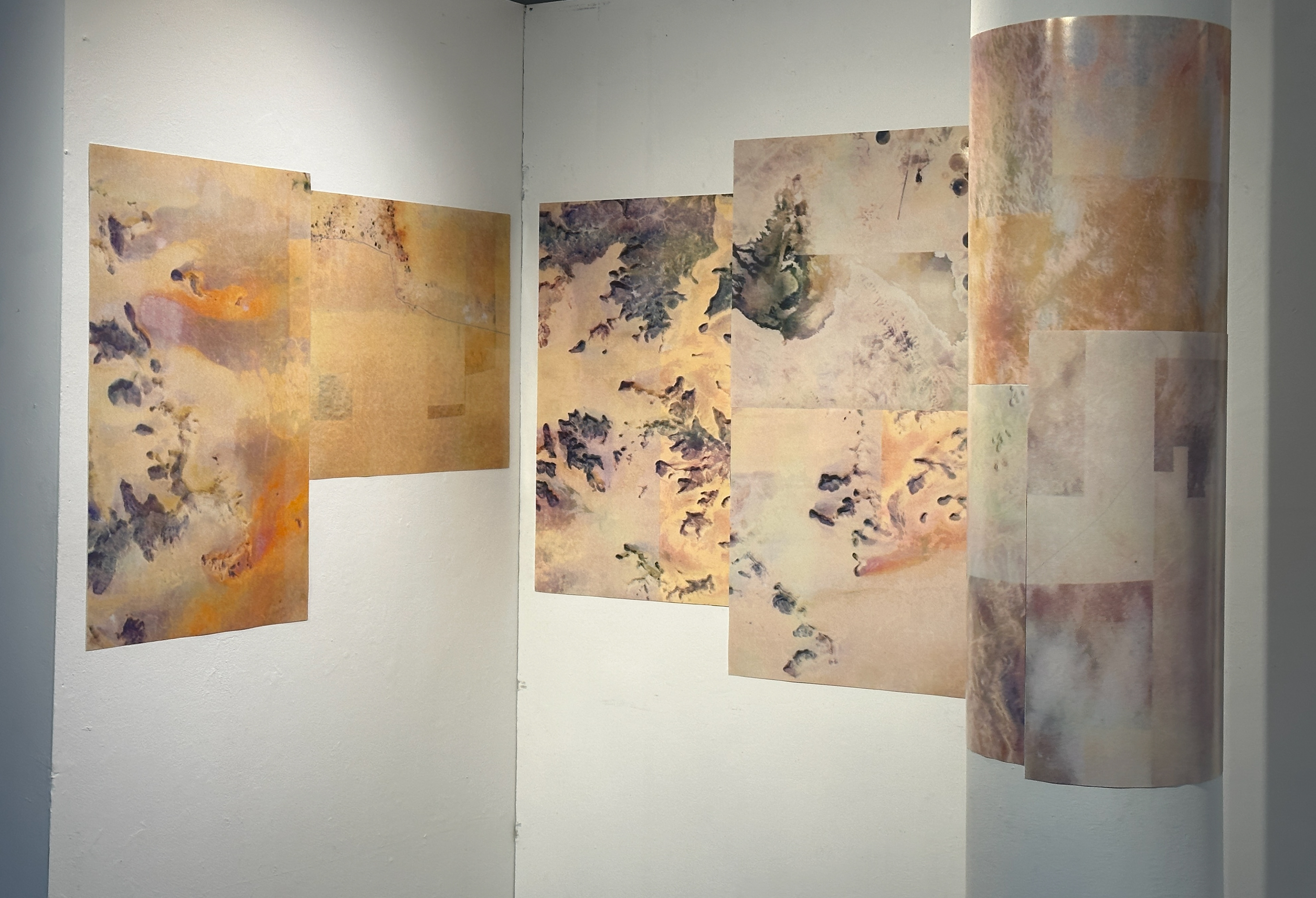
Medium: Print
Material List: Scanned risograph prints of Maxar satelite imagery
My artistic exploration revolves around the captivating realm of space and architecture within my home country, Saudi Arabia. Fascinated by the boundless possibilities offered by satellite imagery accessible through platforms such as Google and Apple Maps, facilitated by Maxar, I embarked on an extensive research journey. Delving into these digital landscapes and immersing myself in a class on Geographic Information Systems (GIS), I unraveled a distinctive aspect that captured my imagination—the occurrence of glitch points.
These glitch points, scattered throughout the mapped territories, revealed fascinating variations in textures and colors within the same geographical and architectural areas. Inspired by this revelation, I embarked on a creative endeavor to amplify and showcase these subtle divergences. Through a meticulous process, I began printing these glitched fragments of the maps, carefully preserving their distinctive qualities. In my artistic practice, I bridge the gaps between glitched landscapes by seamlessly patching together images that share similar glitches and color treatments. By juxtaposing these glitched parts, I aim to emphasize the striking disparities that emerge when different technologies or temporal contexts are employed to capture and represent geographical and architectural features.